

Managing wildlife and public lands is a massive task. Protecting vast habitats, monitoring endangered species, and maintaining park infrastructure requires a ton of coordination. When field crews are working miles away from cellular service in rugged terrain, traditional office systems quickly break down. You end up with communication gaps, paperwork pileups, and delayed responses to critical situations.

To close this gap, forward-thinking agencies are turning to modern operational software to connect their program managers with field teams in real time. By bringing smart automation and mobile-first tools into the field, these organizations are completely transforming how they protect our natural resources.
The Connected Wilderness: Moving from Paper to Salesforce
Daily operations on public lands are highly unpredictable. Dispatchers have to coordinate a diverse group of rangers, researchers, and maintenance crews across expansive territories. Typical scheduling tools often fall short because field work is tied to geographic coordinates and natural landmarks, not standard street addresses.
When field teams rely on paper forms to log environmental changes or asset damage, those records sit in a truck for days. By the time they are typed into a computer back at the office, the data is already old, forcing leaders to make decisions based on lagging indicators.
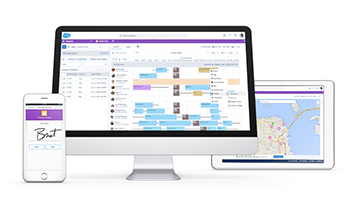
Salesforce Field Service replaces this manual struggle with a clean, digital foundation. The platform unifies work orders, scheduling, and asset tracking in one secure place.
Source: https://admin.salesforce.com/blog/2017/field-operations-set-field-service-lightning
For crews working in deep wilderness, offline-first mobile capabilities are a true game-changer. Field workers can load critical maps and asset histories onto their devices before they head out. They can log updates, snap geotagged photos, and fill out forms completely offline. The moment they get back into cellular range, the system automatically syncs everything to the central database.
We saw the power of this type of digital transformation firsthand in our work with the Tennessee Wildlife Resources Agency.

The agency needed to move away from paper-heavy, manual processes. By taking complex public-facing tasks (like recreational licensing and boat registrations) and bringing them online, they replaced legacy friction with automated, user-friendly portals. It proved that even complex state systems can modernize successfully, giving back-office teams accurate data and a much simpler way to manage daily compliance.
Bringing Autonomy and Spatial Intelligence to the Field
While standard field service systems are great for basic scheduling, Agentforce takes things a step further by adding smart, autonomous coordination.
Instead of working like a basic, rule-based chatbot, Agentforce acts like an active digital teammate. It can analyze incoming citizen requests or sensor data, decide how urgent a repair is, and assign the job to the right crew without anyone in the office needing to click a button.
When you connect Agentforce with real-time sensors via Data 360, you get a proactive approach to conservation. For example, if a sensor on a remote water well or protective gate detects a drop in performance, you don’t have to wait for a total breakdown. Agentforce can flag the issue, check if parts are in stock, and set up a preventive work order for the nearest qualified ranger. This takes a massive administrative load off the field teams, allowing them to focus on hands-on environmental work rather than paperwork.
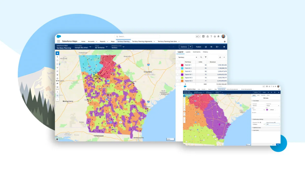
This setup becomes even more powerful when you blend it with map data. Since land management is entirely spatial, integrating your mapping systems is non-negotiable. By putting Esri ArcGIS maps directly inside Salesforce Maps, dispatchers can view wildlife corridors and crew locations side-by-side in a single window. When a ranger marks a nesting area as protected on their mobile device, custom integration patterns update the map in real time. Everyone across the agency instantly looks at the exact same spatial picture.
Source: https://www.salesforce.com/news/stories/new-salesforce-maps-innovations-help-sales-teams-drive-revenue-with-improved-flexibility-and-efficiency/
Designing Resilient Systems with Vectr Solutions
Even though these automated workflows are incredibly powerful, building them requires navigating some real technical and compliance risks. The most critical piece of the puzzle is data quality. AI agents are only as smart as the data underneath them, so you must standardize your asset registries and work types in Data 360 first.
There are also unique rules to consider for offline sync. Because server-side validation rules and automation do not run while a phone is offline, you have to build those custom validations locally on the mobile app to prevent data conflicts when the device reconnects.
At Vectr Solutions, we specialize in helping public sector and state agencies handle these exact challenges. Our team designs and deploys secure, compliant strategies that match complex workflows with real-world user adoption. We build integration architectures that safely bridge core databases, AI engines, and advanced mapping tools without compromising security bounds.
We also configure the precise rules for offline briefcase assignments, aligning user permissions and data filters so sensitive environmental records remain secure on mobile devices. If you are ready to modernize your field operations, cut out manual paperwork, and protect your public lands more efficiently, contact our team today to see how we can help.